The Unique Maps Co.
Old Map of Wrightwood, California by USGS, 1942 – San Gabriel Mountains, Cajon Pass & Mount Baldy
Old Map of Wrightwood, California by USGS, 1942 – San Gabriel Mountains, Cajon Pass & Mount Baldy
Couldn't load pickup availability
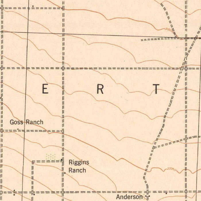
Published in 1942 by the United States Geological Survey, the “San Antonio Quadrangle” captures a dramatic portion of Southern California at a revealing wartime moment, with Wrightwood, Cajon Pass, and the high country of the San Gabriel Mountains rendered in exacting topographic detail. Issued as an advance map, it reflects the USGS practice of making fresh survey information available for practical use while refinement and broader publication programs continued. At a scale of 1:62,500, the map balances regional scope with local precision, allowing the viewer to read both the sweep of mountain systems and the intricacies of canyons, ridges, roads, and settlements. Its title evokes Mount San Antonio—better known as Mount Baldy—one of the defining summits of the range.
The US Geological Survey brought to this sheet the disciplined visual language that made its maps indispensable to engineers, foresters, geologists, travelers, and public agencies. Founded in 1879, the USGS became the nation’s great scientific cartographic institution, standardizing the depiction of terrain across a vast and varied country. Here, brown contour lines describe elevation with quiet authority, while green tints indicate forested areas and vegetation, distinguishing the mountain environment from the drier desert margins beyond. The result is both practical and elegant: a map in which the steep folds of the San Gabriel Mountains, the descending washes, and the human routes threading through them are organized into a legible portrait of landscape.
Wrightwood occupies a compelling position on this map, poised between alpine recreation and the harsher geometry of the Mojave-adjacent valleys. Known today for mountain scenery, hiking, and winter sports, the community appears in relation to the Wrightwood Ski Area, Little Green Valley, Gold Hill, and the surrounding ridgelines that made the region attractive to outdoor enthusiasts. The map’s contours reveal why this area became a natural retreat from the Los Angeles basin and inland valleys: elevation, cooler air, wooded slopes, and immediate access to rugged terrain. Nearby landmarks such as Horse Thief Canyon, Smith Ranch, and Old Gold Mine preserve echoes of ranching, prospecting, and frontier movement embedded in the place-names.
To the south and east, the map gives equal attention to corridors of passage and natural barriers. Cajon Pass and Cajon Junction stand out as crucial gateways between coastal Southern California and the interior deserts, long used by Indigenous travelers, Spanish and Mexican routes, railroads, highways, and later modern traffic. Lytle Creek and the East Fork cut through steep country, their courses made vivid by the contouring of valleys and drainage lines. The San Bernardino National Forest and the slopes around Mount Baldy and Mill Creek show a landscape shaped by elevation, watershed, fire, and access. The map thus records not merely locations, but the physical logic governing movement through Southern California’s mountains.
Viewed from the perspective of the twenty-first century, the 1942 “San Antonio Quadrangle” is especially evocative for what it predates. Apple Valley, Victor Valley, Phelan, Hodge, and the lands around Lake View Point would see changing patterns of settlement, transportation, recreation, and conservation in the decades after World War II. Urban expansion, highway improvement, ski development, forest management, and environmental protection have all altered the region’s relationship to its terrain. Yet the underlying geography remains powerfully present: mountains rising sharply from arid basins, canyons guiding water and travel, passes linking regions, and high ridges framing human ambition. This map preserves that foundational landscape with scientific clarity and historical poise.
Cities, towns and places on this map
- Wrightwood
- San Gabriel Mountains
- San Bernardino National Forest
- Gold Hill
- Apple Valley
- Victor Valley
- Cajon Pass
- Smith Ranch
- East Fork
- Lytle Creek
- Horse Thief Canyon
- Old Gold Mine
- Mount Baldy
- Mill Creek
- Wrightwood Ski Area
- Cajon Junction
- Little Green Valley
- Phelan
- Hodge
- Lake View Point
Historical context & cartographic details
- Published by the US Geological Survey (USGS), a U.S. federal scientific agency known for mapping, surveying, and geographic research.
- Created in 1942, with a 1942 imprint.
- Historical 1:62,500 topographical map of Wrightwood, California, and the surrounding region.
- Marked as an advance map.
- Uses color to represent topographic features, including brown and green shades for elevation changes and vegetation.
- Shows elevation through contour lines and shading, helping depict mountains, valleys, and the physical geography of the area.
- Wrightwood is known for scenic mountain views and outdoor recreation, especially hiking and skiing in the San Gabriel Mountains.
- Since 1942, the region has experienced changes in land use, urban development, and environmental conservation.
Looking for a particular place? Review the detailed images to confirm that the town, landmark or feature you have in mind appears on the map. If you are unsure, ask our workshop to check before you order.
Detailed maps are especially rewarding at larger sizes, where names, boundaries and decorative features have more room to be appreciated. Use the close-up preview and size guide to choose the right scale for your wall.
This map looks amazing at sizes all the way up to 50in (125cm). If you are looking for a larger map, please get in touch.
The model in the listing images is holding the 16x20in (40x50cm) version of this map.
Where personalisation is available, you can add a short title or dedication, mark one meaningful place, or request one considered visual detail. See personalised map examples.
Every piece is printed to museum-grade archival standards using fade-resistant pigment inks on acid-free matte paper. Choose an unframed map print, framed map or canvas using the finish options above. Framed maps use crystal-clear optical acrylic and arrive ready to hang.
With its rich detail and strong sense of place, this map makes a considered gift for a new home, anniversary, retirement or anyone with a personal connection to the area shown. Still deciding? Explore our collection of rare old and vintage maps to discover another place, period or style.
Share