The Unique Maps Co.
Old Map of Rico, Colorado by USGS, 1960 – San Juan National Forest & Dolores River
Old Map of Rico, Colorado by USGS, 1960 – San Juan National Forest & Dolores River
Couldn't load pickup availability
Titled “Rico,” this United States Geological Survey topographic map was published in 1980 using survey data from 1960, preserving a mid-century portrait of one of southwestern Colorado’s most dramatic mountain settings. Centered on the historic town of Rico, the map captures a landscape shaped by mining, water, forest, and elevation. Rico lies in a high valley along the Dolores River, surrounded by steep slopes and rugged summits that rise quickly from the townsite. The sheet records not only a place, but a moment: before later decades of changing infrastructure, recreation, conservation priorities, and land-use patterns reshaped how residents and visitors moved through this part of the San Juan Mountains.
The USGS brought to this map the precision that made it indispensable to explorers, engineers, scientists, land managers, and outdoor travelers. Founded in 1879, the United States Geological Survey became the nation’s authoritative cartographic voice for terrain, geology, hydrology, and natural resources. In “Rico,” that institutional clarity is evident in the disciplined contouring, measured grid, named waterways, roads, trails, and forest boundaries. At a 1:24,000 scale, the map offers a close reading of the land, where every bend of Cascade Creek, Bear Creek, Dutch Creek, and the Dolores River contributes to a larger understanding of drainage, access, and settlement in a demanding alpine environment.
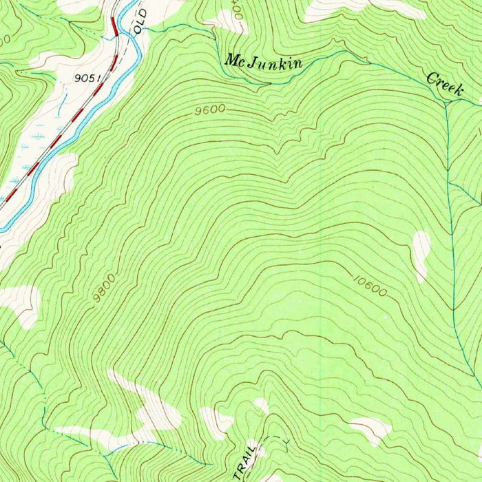
The cartographic style is classic USGS topography, elegant in its purposeful restraint. Green tones indicate forested or lower-elevation areas, while brown contour lines climb and tighten across the higher ridges, revealing the muscular terrain of the San Juans. The effect is both technical and beautiful: slopes, valleys, saddles, and peaks emerge through a careful language of line and color. Around Rico, the contours gather thickly, emphasizing the town’s enclosure by mountains and the abrupt verticality that defines this region. Such detail gives the map a sculptural quality, allowing the viewer to read the terrain almost as though light were falling across a relief model.
Among the prominent features are Elk Mountain, Ethel Mountain, Spencer Mountain, and Black Hawk Pass, each anchoring the map in the high country surrounding Rico. These names evoke the layered history of Colorado’s mountain West: mineral exploration, seasonal travel, stock routes, forestry, and the later rise of recreational backcountry use. Groundhog Lake appears as a quiet counterpoint to the steep landforms, while the streams radiating through the quadrangle suggest both natural abundance and physical constraint. Roads and trails thread through valleys and passes, revealing the practical routes by which people navigated a landscape where geology dictated movement.
The inclusion of San Juan National Forest places the map within a broader story of public land stewardship in the American West. By 1960, the region was already negotiating the legacies of mining with emerging priorities of conservation, watershed protection, timber management, and outdoor recreation. This map records that transitional moment with exceptional clarity, showing a mountain environment both inhabited and wild. Rico itself, once a mining town, appears as a human foothold amid forests, creeks, and imposing ridgelines. For collectors and admirers of Colorado history, the map offers a refined and information-rich window into a place where settlement, wilderness, and topography remain inseparable.
Cities, towns and places on this map
- Rico, Colorado
- San Juan National Forest
- Elk Mountain
- Ethel Mountain
- Spencer Mountain
- Dolores River
- Groundhog Lake
- Cascade Creek
- Bear Creek
- Dutch Creek
- Black Hawk Pass
- Various trails and roads connecting the mentioned locations
Historical context & cartographic details
- Map name: Rico
- Produced by the United States Geological Survey (USGS)
- Historical 1:24,000 topographical map showing Rico, Colorado and the surrounding area
- Dated 1960 and published with a 1980 imprint
- The USGS is known for detailed geological, hydrological, and topographical mapping
- The map uses color gradients to show elevation, with green for lower elevations and brown tones for higher elevations
- Contour lines delineate hills, valleys, slopes, and the mountainous terrain of southwestern Colorado
- The 1960 data reflects a period of development and ecological change in the area
- Later changes in infrastructure, land use, conservation, and recreation provide context for the area’s present-day significance
Looking for a particular place? Review the detailed images to confirm that the town, landmark or feature you have in mind appears on the map. If you are unsure, ask our workshop to check before you order.
Detailed maps are especially rewarding at larger sizes, where names, boundaries and decorative features have more room to be appreciated. Use the close-up preview and size guide to choose the right scale for your wall.
This map looks amazing at sizes all the way up to 50in (125cm). If you are looking for a larger map, please get in touch.
The model in the listing images is holding the 16x20in (40x50cm) version of this map.
Where personalisation is available, you can add a short title or dedication, mark one meaningful place, or request one considered visual detail. See personalised map examples.
Every piece is printed to museum-grade archival standards using fade-resistant pigment inks on acid-free matte paper. Choose an unframed map print, framed map or canvas using the finish options above. Framed maps use crystal-clear optical acrylic and arrive ready to hang.
With its rich detail and strong sense of place, this map makes a considered gift for a new home, anniversary, retirement or anyone with a personal connection to the area shown. Still deciding? Explore our collection of rare old and vintage maps to discover another place, period or style.
Share