The Unique Maps Co.
Old Map of Lambertville, New Jersey by USGS, 1894 – New Hope, Delaware River & Trenton
Old Map of Lambertville, New Jersey by USGS, 1894 – New Hope, Delaware River & Trenton
Couldn't load pickup availability
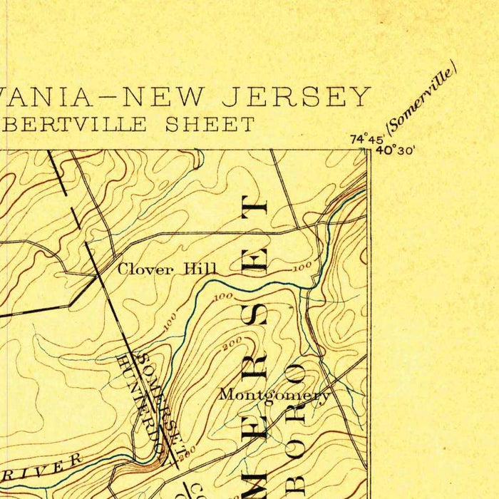
Titled “Lambertville,” this United States Geological Survey topographical map was created in 1894 and published with an 1898 imprint, capturing the Delaware River borderlands at a moment of quiet but consequential transition. Centered on Lambertville, New Jersey, and New Hope, Pennsylvania, it presents a finely observed portrait of two historic river towns whose identities were shaped by ferry crossings, canals, mills, rail connections, and the dramatic landscape of the Delaware Valley. At a scale of 1:62,500, the map balances regional breadth with local specificity, extending across portions of Hunterdon, Mercer, and Bucks counties. Its disciplined USGS style privileges clarity and precision, allowing roads, waterways, settlements, and relief to emerge as a richly layered record of place.
The mapmaker, the US Geological Survey, was by the late nineteenth century establishing a new national standard for scientific cartography. Rather than decorative flourish, the sheet relies on the quiet authority of contour lines, hydrographic detail, and carefully classified cultural features. These marks reveal not simply where towns and roads stood, but how human settlement conformed to the terrain. Around Lambertville and New Hope, closely spaced contours describe the hilly shoulders rising from the Delaware River, while gentler intervals indicate the more open agricultural lands beyond. This is cartography as measurement and interpretation: a practical government map that now reads as an elegant historical document of landscape, infrastructure, and settlement.
The Delaware River is the commanding natural feature, tracing a sinuous north-south course between New Jersey and Pennsylvania and binding the region’s communities together even as it marks a state boundary. Lambertville and New Hope appear as paired settlements across the water, their long relationship evident in the roads and crossings that converge upon the river corridor. Nearby places such as Titusville, Yardley, Lower Makefield, Solebury, West Amwell, and Pennington situate the towns within a broader network of farms, villages, and market routes. Washington Crossing adds a powerful historical resonance, recalling the Revolutionary War landscape through which later nineteenth-century transport, commerce, and daily life continued to move.
Water engineering and natural drainage are especially prominent. The Delaware & Raritan Canal and the New Jersey Canal corridor speak to the industrial and commercial ambitions that transformed central New Jersey in the nineteenth century, linking inland production to major markets. Creeks and rivers, including Assunpink Creek and the Raritan River system, are rendered with the precision expected of USGS survey work, showing how water shaped both movement and settlement. The map also reaches toward Trenton, Flemington, Ringoes, Mountain Lake, and the Amwell Valley, assembling a landscape where agricultural valleys, wooded slopes, canal lines, and town centers form an intricate geographic tapestry.
What makes this map particularly compelling is its ability to preserve the terrain before modern expansion softened or obscured many historical relationships. The contouring reveals the physical character of the Delaware River highlands and surrounding valleys, while the mapped roads, canals, and settlements show communities still closely tied to water, topography, and local industry. Lambertville and New Hope, now celebrated for architectural heritage and cultural charm, appear here within their working nineteenth-century setting: practical, connected, and inseparable from the river. More than a technical survey, the map offers a poised historical view of a border region where geology, transportation, and human habitation meet with remarkable clarity.
Cities, towns and places on this map
- Lambertville, NJ
- New Hope, PA
- Hunterdon County
- Mercer County
- Delaware River
- Assunpink Creek
- Amwell Valley
- Lower Makefield
- Solebury
- Yardley
- New Jersey Canal
- West Amwell
- Raritan River
- Washington Crossing
- Trenton
- Flemington, NJ
- Pennington
- Titusville
- Delaware & Raritan Canal
- Mountain Lake
- Ringoes
Historical context & cartographic details
- Produced by the US Geological Survey as a historical 1:62,500 topographical map.
- Created in 1894 and published with an 1898 imprint.
- Reflects the USGS tradition of detailed, accurate topographical mapping using advanced surveying techniques of the period.
- Features contour lines indicating elevation changes, a defining characteristic of late nineteenth-century topographic mapping.
- Uses a practical, utilitarian cartographic style that prioritizes clarity and function over decoration.
- Includes intricate contour lines and shading to show the hilly terrain of the region.
- Provides a historical view of local development and geographic features over more than a century.
- Notable for its careful portrayal of contours and waterways.
Looking for a particular place? Review the detailed images to confirm that the town, landmark or feature you have in mind appears on the map. If you are unsure, ask our workshop to check before you order.
Detailed maps are especially rewarding at larger sizes, where names, boundaries and decorative features have more room to be appreciated. Use the close-up preview and size guide to choose the right scale for your wall.
This map looks amazing at sizes all the way up to 50in (125cm). If you are looking for a larger map, please get in touch.
The model in the listing images is holding the 16x20in (40x50cm) version of this map.
Where personalisation is available, you can add a short title or dedication, mark one meaningful place, or request one considered visual detail. See personalised map examples.
Every piece is printed to museum-grade archival standards using fade-resistant pigment inks on acid-free matte paper. Choose an unframed map print, framed map or canvas using the finish options above. Framed maps use crystal-clear optical acrylic and arrive ready to hang.
With its rich detail and strong sense of place, this map makes a considered gift for a new home, anniversary, retirement or anyone with a personal connection to the area shown. Still deciding? Explore our collection of rare old and vintage maps to discover another place, period or style.
Share