The Unique Maps Co.
Old Map of Great Sand Dunes National Park, Colorado by USGS, 1967 – Sangre de Cristo Mountains & Medano Creek
Old Map of Great Sand Dunes National Park, Colorado by USGS, 1967 – Sangre de Cristo Mountains & Medano Creek
Couldn't load pickup availability
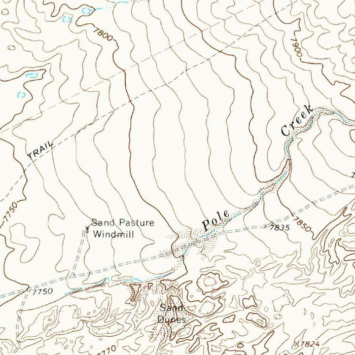
Published under the original title “Sand Camp,” this US Geological Survey topographic map is dated 1967 and carries a 1985 imprint, preserving a mid-20th-century view of one of Colorado’s most extraordinary landscapes. At a precise 1:24,000 scale, it captures the Great Sand Dunes area at the foot of the Sangre de Cristo Mountains, where wind, water, and elevation combine to create the tallest sand dunes in North America. The map records the terrain with disciplined contour work, revealing the abrupt transition from sweeping sand sheets to rugged mountain slopes. Its subject is both stark and majestic: a place where desert-like forms meet alpine geology, and where the geography itself seems in motion.
The US Geological Survey brought its characteristic clarity and scientific rigor to “Sand Camp,” using standardized symbology to translate a complex natural environment into a highly legible cartographic record. Contour lines, elevation points, drainage features, roads, and land boundaries are rendered with the precision that made USGS maps indispensable to geologists, hikers, engineers, and land managers. In this terrain, those details are especially meaningful: subtle variations in elevation define the dunes, while sharper contour intervals mark the rising flanks of the Sangre de Cristo range. The map reflects a period when federal mapping was not merely descriptive, but instrumental in understanding, conserving, and navigating America’s public lands.
Great Sand Dunes dominates the map’s historical and visual interest, offering a rare cartographic portrait of a landscape shaped by powerful natural forces. Sand eroded from surrounding mountains and valley sediments was carried by wind toward the Sangre de Cristos, where opposing air currents and seasonal waterways helped trap and build the dunes. Medano Creek, one of the most distinctive features of the region, appears as part of this dynamic system, flowing along the base of the dunes and helping define their shifting edge. The map’s contouring gives structure to an environment often imagined as featureless, showing that the dunes themselves possess ridges, basins, slopes, and elevations worthy of careful survey.
Beyond the dunes, the map situates Sand Camp within a broader Colorado geography of mountains, valleys, water, and passageways. The Sangre de Cristo Mountains form a dramatic eastern boundary, with regional high points such as Blanca Peak and Mount Lindsey evoking the alpine world that rises beyond the sandy basin. Mosca Pass recalls historic routes through the range, while San Luis Lake and the wider San Luis Valley suggest the hydrological setting that helped shape the dunes over millennia. Nearby routes such as Highway 160 connect this remote landscape to the towns and corridors of southern Colorado, emphasizing how the map balances wilderness, access, and scientific observation.
As a document of 1960s geographical knowledge, “Sand Camp” belongs to an era when ecological conservation was gaining new urgency in the United States. Great Sand Dunes had already been recognized for protection, and maps like this helped define the landforms, watersheds, and access points essential to its management and public appreciation. The sheet is especially compelling because it records a landscape that is both ancient and continually changing: dunes migrate, creeks surge and vanish seasonally, and mountain weather reshapes the margins of the basin. In its careful lines and measured symbols, the map offers more than orientation—it presents a finely observed portrait of one of the American West’s most singular natural theaters.
Cities, towns and places on this map
- Great Sand Dunes National Park
- San Luis Lake
- Blanca Peak
- Mount Lindsey
- Medano Creek
- Rio Grande River
- Highway 160
- Mosca Pass
- Sangre de Cristo Mountains
- La Garita Wilderness
- Saguache County
- Baca County
- Various contour lines and elevation points
Historical context & cartographic details
- Map name: Sand Camp
- Produced by the US Geological Survey as a historical 1:24,000 topographical map of Colorado.
- Dated 1967, with a 1985 imprint.
- Published by the US Geological Survey, known for detailed and accurate topographical mapping in the United States.
- Features detailed topographical contours and landmarks.
- Uses standard USGS symbology to identify geographical features.
- Shows intricate contour lines indicating elevation changes across the dunes and surrounding mountain terrain.
- Reflects 1960s geographical knowledge and a period of growing ecological conservation interest.
Looking for a particular place? Review the detailed images to confirm that the town, landmark or feature you have in mind appears on the map. If you are unsure, ask our workshop to check before you order.
Detailed maps are especially rewarding at larger sizes, where names, boundaries and decorative features have more room to be appreciated. Use the close-up preview and size guide to choose the right scale for your wall.
This map looks amazing at sizes all the way up to 50in (125cm). If you are looking for a larger map, please get in touch.
The model in the listing images is holding the 16x20in (40x50cm) version of this map.
Where personalisation is available, you can add a short title or dedication, mark one meaningful place, or request one considered visual detail. See personalised map examples.
Every piece is printed to museum-grade archival standards using fade-resistant pigment inks on acid-free matte paper. Choose an unframed map print, framed map or canvas using the finish options above. Framed maps use crystal-clear optical acrylic and arrive ready to hang.
With its rich detail and strong sense of place, this map makes a considered gift for a new home, anniversary, retirement or anyone with a personal connection to the area shown. Still deciding? Explore our collection of rare old and vintage maps to discover another place, period or style.
Share