The Unique Maps Co.
Old Map of Gardnerville, Nevada by USGS, 1893 – Minden, Genoa & Lake Tahoe
Old Map of Gardnerville, Nevada by USGS, 1893 – Minden, Genoa & Lake Tahoe
Couldn't load pickup availability
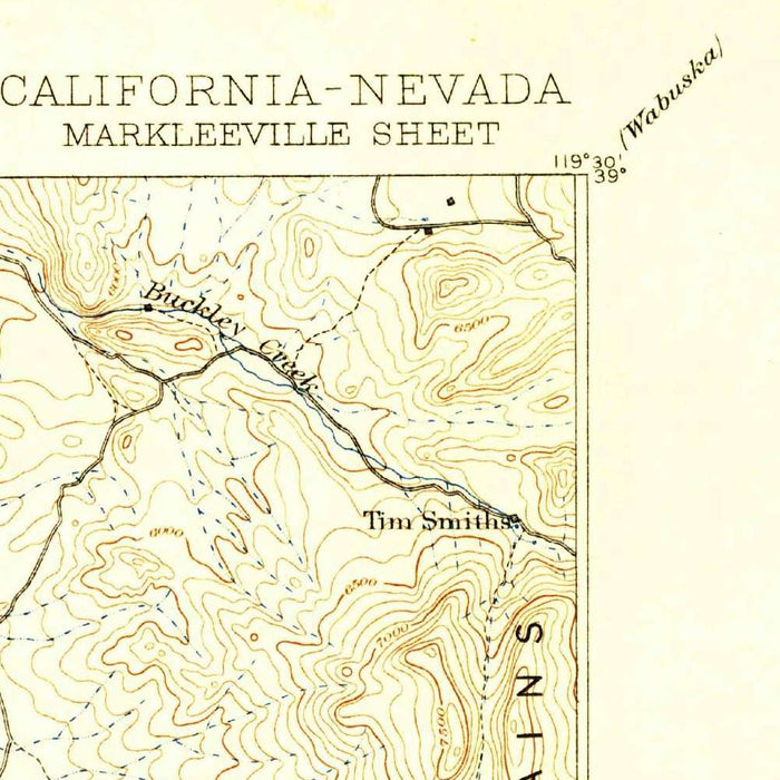
The US Geological Survey’s “Markleeville” presents a richly detailed topographical portrait of the Sierra Nevada–Carson Valley borderlands, dated 1893 and bearing a 1930 imprint. At a scale of 1:125,000, it captures an expansive mountain landscape where eastern California and western Nevada meet in a dramatic sequence of valleys, passes, rivers, lakes, and high ridges. Gardnerville, Minden, Genoa, and Markleeville appear within a terrain shaped by the Carson River system and the formidable rise of the Sierra Nevada Mountains. The map’s original title is spare and evocative, naming a small alpine community while encompassing a much broader region of strategic routes, settlement corridors, and rugged high country.
Produced by the US Geological Survey, the map reflects the disciplined scientific cartography for which the agency became renowned in the late nineteenth and early twentieth centuries. Its contour lines do more than describe elevation; they reveal the structure of the land with remarkable clarity, tightening around steep slopes and opening across valleys, basins, and flats. The visual language is both practical and elegant, allowing the viewer to trace ridgelines, interpret drainage patterns, and understand why communities developed where they did. In the Markleeville sheet, topography is not merely background—it is the central subject, shaping movement, habitation, water access, and the relationship between Nevada’s open valleys and California’s mountainous interior.
Gardnerville and Minden anchor the Nevada side of the map within Carson Valley, one of the most historically important agricultural and settlement areas east of the Sierra. Nearby Genoa, among Nevada’s earliest permanent settlements, hints at the region’s pioneer history and its role as a foothold between mountain crossings and interior valleys. Kingsbury Grade, Fish Springs, Indian Creek, and Osgood Swamp add further texture to the human and natural geography. The East Fork and West Fork of the Carson River thread through the landscape, giving coherence to the map’s web of towns, roads, meadows, and drainage basins. These waterways were vital to travel, ranching, irrigation, and settlement in an otherwise demanding high-desert and mountain environment.
The California side of the map rises into the Sierra Nevada, where Hope Valley, Woodfords, Wolf Creek, Silver Creek, Red Lakes, Mud Lake, and Carson Pass evoke a world of alpine meadows, cold streams, and high routes over the range. Jobs Peak dominates the terrain near the Nevada-California line, its contours expressing the abrupt vertical drama that defines this part of the Sierra front. Lake Tahoe and the South Lake Tahoe area appear as part of a larger geography of mountain basins and water systems, connecting the map to one of the West’s most celebrated natural landmarks. The juxtaposition of Tahoe, Carson Valley, and the high passes gives the sheet exceptional geographic variety.
As a historical document, “Markleeville” preserves a late nineteenth-century understanding of a region undergoing transition, where older travel corridors, rural settlements, ranch lands, and mountain routes coexisted with emerging modern infrastructure and government survey work. The 1930 imprint underscores the continued value of earlier survey data, suggesting a landscape whose physical form remained constant even as roads, communities, and economic uses evolved. Today, the map invites comparison between past and present: settlements have grown, place names have shifted in prominence, and recreational associations with Tahoe and the Sierra have deepened. Yet the essential geography—rivers, ridges, passes, lakes, and valleys—remains powerfully legible through the USGS’s refined topographic craft.
Cities, towns and places on this map
- Gardnerville
- Markleeville
- Minden
- Fish Springs
- Genoa
- Hope Valley
- Kingsbury Grade
- Indian Creek
- Carson Valley
- South Lake Tahoe
- Lake Tahoe
- East Fork Carson River
- West Fork Carson River
- Sierra Nevada Mountains
- Jobs Peak
- Red Lakes
- Silver Creek
- Mud Lake
- Osgood Swamp
- Woodfords
- Wolf Creek
- Carson Pass
Historical context & cartographic details
- Map title: Markleeville
- Produced by the US Geological Survey.
- Historical 1:125,000 topographical map showing Gardnerville, Nevada and the surrounding area.
- Dated 1893 with a 1930 imprint.
- Published by the US Geological Survey, known for detailed topographic mapping of terrain, elevation, and geographic features in the United States.
- Uses contour lines to depict elevation and relief, characteristic of USGS topographical maps.
- Contour lines vary in thickness and spacing to indicate different elevations.
- Shows varying elevations, mountainous terrain, valleys, and water bodies.
- Serves as a snapshot from the late 19th to early 20th century, reflecting land use, settlement patterns, and geographic knowledge of the time.
- Provides a detailed representation of the region’s topography, aiding navigation and understanding of the area over time.
Looking for a particular place? Review the detailed images to confirm that the town, landmark or feature you have in mind appears on the map. If you are unsure, ask our workshop to check before you order.
Detailed maps are especially rewarding at larger sizes, where names, boundaries and decorative features have more room to be appreciated. Use the close-up preview and size guide to choose the right scale for your wall.
This map looks amazing at sizes all the way up to 50in (125cm). If you are looking for a larger map, please get in touch.
The model in the listing images is holding the 16x20in (40x50cm) version of this map.
Where personalisation is available, you can add a short title or dedication, mark one meaningful place, or request one considered visual detail. See personalised map examples.
Every piece is printed to museum-grade archival standards using fade-resistant pigment inks on acid-free matte paper. Choose an unframed map print, framed map or canvas using the finish options above. Framed maps use crystal-clear optical acrylic and arrive ready to hang.
With its rich detail and strong sense of place, this map makes a considered gift for a new home, anniversary, retirement or anyone with a personal connection to the area shown. Still deciding? Explore our collection of rare old and vintage maps to discover another place, period or style.
Share