The Unique Maps Co.
Old Map of Franconia, New Hampshire by USGS, 1967 – Franconia Notch & Cannon Mountain
Old Map of Franconia, New Hampshire by USGS, 1967 – Franconia Notch & Cannon Mountain
Couldn't load pickup availability
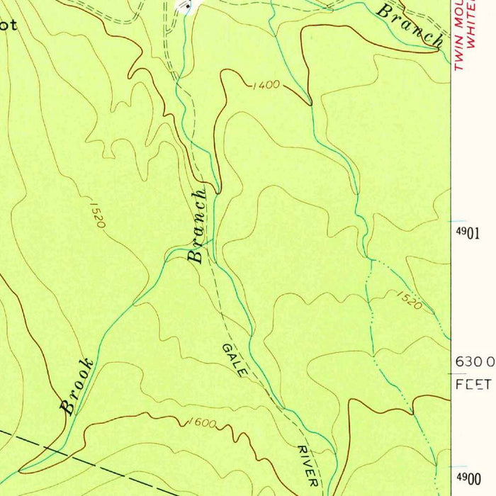
Published in 1979 from mapping originally made in 1967, the US Geological Survey’s “Franconia” presents one of New Hampshire’s most dramatic mountain landscapes with the precision and quiet authority for which USGS quadrangles are renowned. At a scale of 1:24,000, it captures the village of Franconia and its surrounding high country in unusually fine detail, from roads and settlements to brooks, lakes, trails, cliffs, and summit contours. The green woodland tint, crisp contouring, and carefully lettered place names evoke the classic mid-century American topographic style: practical, exacting, and deeply atmospheric. More than a navigational document, the map records a moment in the modern history of the White Mountains, when recreation, conservation, and infrastructure were reshaping the relationship between people and this rugged alpine terrain.
Franconia Notch dominates the map’s geography and imagination. This narrow pass through the White Mountains has long been one of New England’s most celebrated natural corridors, framed by steep slopes, glacially carved walls, and storied landmarks. Cannon Mountain rises to the west, while Mount Lafayette and Mount Lincoln anchor the formidable Franconia Range to the east, their contours gathered in tight, expressive bands that make the relief almost palpable. The Cannon Cliffs, a landmark of New Hampshire climbing history, are marked within a landscape where verticality defines the scene. Nearby Profile Lake and Echo Lake add stillness to the rugged composition, their waters set amid forest, talus, roadways, and trails.
The map also traces the human pathways through this mountain world. State Routes 93 and 3 appear as vital arteries through Franconia Notch, reflecting the growing importance of automobile tourism in the White Mountains during the twentieth century. Lafayette Campground, The Flume, and the Basin speak to a landscape increasingly organized for public access, yet still dominated by topography rather than development. Trails and paths thread across ridges, through forests, and toward summits, suggesting the long tradition of walking and climbing in this region. Crossroad Station, Smith Brook, Beaver Brook, and the Gale River provide quieter points of orientation, revealing the dense web of local names and natural features that gives the quadrangle its richness.
As a USGS topographic map, “Franconia” belongs to one of the great cartographic projects of the United States: the systematic mapping of the nation’s terrain for science, infrastructure, resource management, and public use. The agency’s work combined field survey, aerial photography, and standardized design conventions to create maps of enduring clarity. Here, contour lines do more than indicate elevation; they narrate the shape of the land, from the valley floors around Franconia and Sugar Hill to the steep ascents toward the Kinsmans, Cannon Mountain, and the Franconia Ridge. The result is a disciplined yet evocative portrait of a place where geology, hydrology, forest cover, and human access are all carefully interwoven.
Historically, this quadrangle offers a valuable record of the Franconia area at the close of the 1960s, a period when the White Mountain National Forest was central to conservation, recreation, and regional identity. The map preserves the arrangement of roads, campsites, watercourses, and trails before later decades of tourism pressure and environmental management altered aspects of the landscape. It situates Franconia, Little Franconia, Haverhill, Sugar Hill, Kinsman Notch, and the Pemigewasset River within a broader mountain setting that had already become iconic in American outdoor culture. Elegant in its restraint and rich in geographic intelligence, it captures the White Mountains not as scenery alone, but as a lived, traveled, and carefully studied terrain.
Cities, towns and places on this map
- Franconia
- Franconia Notch
- Cannon Mountain
- White Mountain National Forest
- Little Franconia
- Smith Brook
- Profile Lake
- Echo Lake
- The Cannon Cliffs
- Gale River
- Mount Lafayette
- Mount Lincoln
- Lafayette Campground
- Crossroad Station
- The Flume
- Basin
- Sugar Hill
- Haverhill
- Kinsman Notch
- Beaver Brook
- The Pemigewasset River
- State Route 93
- State Route 3
- Various trails and paths in the area
Historical context & cartographic details
- Produced by the US Geological Survey as a historical 1:24,000 topographical map.
- Originally made in 1967 and published with a 1979 imprint.
- Uses a green palette to represent elevation and terrain features.
- Includes contour lines to show topography and elevation changes.
- Depicts mountainous terrain typical of the White Mountains.
- Provides a detailed record of the area’s landscape during the 1960s.
- Offers insight into changes in land use, development, and conservation efforts over time.
Looking for a particular place? Review the detailed images to confirm that the town, landmark or feature you have in mind appears on the map. If you are unsure, ask our workshop to check before you order.
Detailed maps are especially rewarding at larger sizes, where names, boundaries and decorative features have more room to be appreciated. Use the close-up preview and size guide to choose the right scale for your wall.
This map looks amazing at sizes all the way up to 50in (125cm). If you are looking for a larger map, please get in touch.
The model in the listing images is holding the 16x20in (40x50cm) version of this map.
Where personalisation is available, you can add a short title or dedication, mark one meaningful place, or request one considered visual detail. See personalised map examples.
Every piece is printed to museum-grade archival standards using fade-resistant pigment inks on acid-free matte paper. Choose an unframed map print, framed map or canvas using the finish options above. Framed maps use crystal-clear optical acrylic and arrive ready to hang.
With its rich detail and strong sense of place, this map makes a considered gift for a new home, anniversary, retirement or anyone with a personal connection to the area shown. Still deciding? Explore our collection of rare old and vintage maps to discover another place, period or style.
Share