The Unique Maps Co.
Old Map of Cornwall, Connecticut by USGS, 1950 – Lake Waramaug, Mohawk Mountain & Housatonic River
Old Map of Cornwall, Connecticut by USGS, 1950 – Lake Waramaug, Mohawk Mountain & Housatonic River
Couldn't load pickup availability
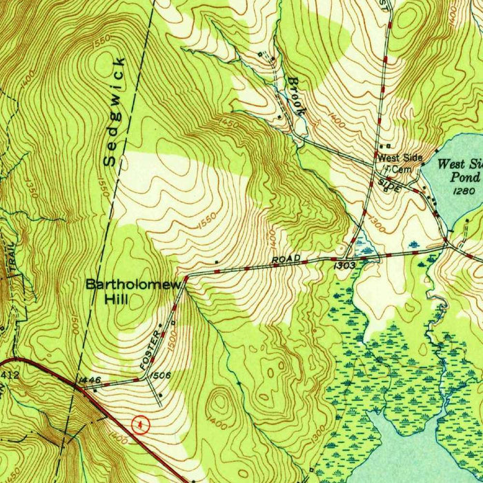
Published in 1950 by the United States Geological Survey, “Cornwall” presents a finely detailed topographical portrait of one of northwestern Connecticut’s most picturesque hill towns and its surrounding uplands. Drawn at a 1:31,680 scale, the map captures Cornwall at a moment when rural New England was balancing long-established agricultural patterns with mid-century roads, recreation, and forest conservation. Its title is spare and elegant, but the landscape it describes is richly varied: ridges, valleys, streams, villages, mountain roads, and wooded state lands are all rendered through the disciplined visual language of USGS cartography. Brown contour lines describe the rise and fall of the terrain, while greens, blues, and black linework distinguish forests, watercourses, settlements, and transportation routes.
The US Geological Survey, founded in 1879, became the definitive cartographic authority for mapping the physical character of the United States, and this map is an excellent example of its mid-20th-century topographic style. USGS maps were not merely navigational aids; they were scientific instruments, designed to serve geologists, engineers, planners, land managers, and travelers alike. Here, the agency’s precision is visible in every contour interval, road classification, stream trace, and elevation mark. The result is a map that feels both technical and poetic: a measured survey of landforms, yet also an evocative image of Connecticut’s Litchfield Hills. Its restrained palette and dense information reflect an era when government cartography combined field observation, standardized symbology, and practical beauty.
Cornwall itself lies within a landscape shaped by steep hills, forested slopes, and narrow waterways, all vividly expressed through the map’s contouring. The hilly terrain is one of its defining features, with lines tightening around ridges and summits to reveal the dramatic relief that gives this region its character. Mohawk Mountain and the surrounding high ground stand out as prominent landmarks, emphasizing Cornwall’s place among the rugged uplands of western Connecticut. Nearby state forest lands, including Mohawk State Forest, indicate the growing importance of conservation and outdoor recreation in the mid-20th century. Roads and trails thread through this topography, revealing the practical routes by which residents and visitors negotiated a demanding but beautiful terrain.
Water is another structuring presence on the map, from the Housatonic River to smaller streams, ponds, and drainage channels that knit the landscape together. The Housatonic, one of the major rivers of western New England, marks an important natural corridor, historically significant for settlement, transport, industry, and ecology. To the south and west, Lake Waramaug appears as a notable body of water associated with the adjoining towns of Warren and Washington, reflecting the broader recreational geography of the region. Smaller streams and wetlands, carefully delineated, show how water descends through the hills toward larger valleys. These features make the map especially valuable for understanding not only settlement patterns, but also watershed structure and the environmental logic of the area.
Beyond Cornwall, the map includes neighboring communities and rural districts such as Warren and Goshen, placing the town within a wider network of Litchfield County roads, ridgelines, and valleys. The road labels and route markings offer a revealing snapshot of transportation before later decades of suburban expansion and highway modernization. Farm clearings, wooded tracts, trails, elevations, and village centers together preserve a mid-century record of land use, showing where settlement clustered and where terrain remained largely forested. As a historical document, the map invites comparison with the present: roads have changed, forests have matured, recreational lands have evolved, and development patterns have shifted. Yet the enduring framework of mountains, rivers, lakes, and valleys remains beautifully legible.
Cities, towns and places on this map
- Cornwall
- Warren
- Goshen
- Lake Waramaug
- Mohawk Mountain
- Housatonic River
- Mohawk State Forest
- Roads and trails identified by numbers and labels
- Streams and smaller water bodies
- Notable elevations and peaks within the region
Historical context & cartographic details
- Produced by the US Geological Survey, this historical topographical map shows Cornwall, Connecticut and the surrounding area in 1950.
- Drawn at a scale of 1:31,680.
- Published by the US Geological Survey, a U.S. government scientific agency known for detailed topographical surveys and national mapping work since 1879.
- Uses a traditional USGS topographic design, with contour lines indicating elevation changes.
- Includes detailed symbols for land use, roads, water features, and geographical features.
- Features a color palette typical of mid-20th-century USGS maps, with elevations highlighted in browns and greens.
- Shows the hilly terrain characteristic of Cornwall, with significant elevation changes clearly marked.
- Reflects mid-20th-century land use and development patterns, useful for comparison with modern maps.
Looking for a particular place? Review the detailed images to confirm that the town, landmark or feature you have in mind appears on the map. If you are unsure, ask our workshop to check before you order.
Detailed maps are especially rewarding at larger sizes, where names, boundaries and decorative features have more room to be appreciated. Use the close-up preview and size guide to choose the right scale for your wall.
This map looks amazing at sizes all the way up to 50in (125cm). If you are looking for a larger map, please get in touch.
The model in the listing images is holding the 16x20in (40x50cm) version of this map.
Where personalisation is available, you can add a short title or dedication, mark one meaningful place, or request one considered visual detail. See personalised map examples.
Every piece is printed to museum-grade archival standards using fade-resistant pigment inks on acid-free matte paper. Choose an unframed map print, framed map or canvas using the finish options above. Framed maps use crystal-clear optical acrylic and arrive ready to hang.
With its rich detail and strong sense of place, this map makes a considered gift for a new home, anniversary, retirement or anyone with a personal connection to the area shown. Still deciding? Explore our collection of rare old and vintage maps to discover another place, period or style.
Share