The Unique Maps Co.
Map of Shaver Lake, California by USGS, 2004 – Sierra National Forest & Sierra Nevada
Map of Shaver Lake, California by USGS, 2004 – Sierra National Forest & Sierra Nevada
Couldn't load pickup availability
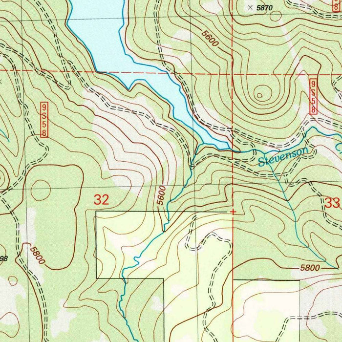
Titled “Shaver Lake,” this U.S. Geological Survey map was surveyed in 2004 and published with a 2007 imprint, presenting a precise portrait of one of the Sierra Nevada’s cherished mountain landscapes at the beginning of the twenty-first century. At the heart of the sheet lies Shaver Lake, a high-country reservoir long associated with boating, fishing, camping, and summer retreat. The map situates the lake within a broader matrix of ridges, forested slopes, roads, streams, and recreational sites, offering a richly detailed view of how natural terrain and human access interlace in this part of California.
The U.S. Geological Survey, founded in 1879, became the nation’s preeminent authority on topographic mapping, and this sheet reflects the agency’s enduring commitment to scientific clarity. Its 1:24,000 scale allows roads, trails, campgrounds, picnic areas, watercourses, and relief features to be read with remarkable specificity. The familiar USGS topographic language—contour lines, color-coded land cover, hydrographic blue, and carefully labeled cultural features—transforms the Sierra landscape into an elegant system of measurement and meaning. For collectors, such maps are valued not only as navigational documents, but as disciplined visual records of place at a particular historical moment.
The terrain around Shaver Lake is unmistakably Sierra Nevada: steep slopes, rounded ridges, forested basins, and descending tributaries that speak to both granite geology and mountain hydrology. The contour lines gather tightly where the land rises abruptly, then relax across gentler benches and accessible corridors, making the map especially expressive of elevation and relief. Nearby peaks and ridgelines frame the lake’s watershed, while streams and smaller drainage channels reveal the hidden structure of the mountains. The result is a landscape that can be appreciated at once as wilderness, recreation ground, engineered reservoir, and ecological system.
Sierra National Forest plays a defining role in the geography shown here, surrounding Shaver Lake with protected woodland, recreation infrastructure, and mountain routes. Campgrounds, picnic areas, and trail corridors appear as part of a broader recreational network, marking the ways visitors move through and inhabit the landscape seasonally. Paved and gravel roads trace the practical lines of access, while hiking routes suggest quieter passages into the surrounding forest and ridges. The map captures a region where public land management, outdoor leisure, and environmental stewardship converge, making it a revealing document of California’s high-country recreational culture.
As a historical record, “Shaver Lake” preserves the configuration of roads, trails, forest boundaries, water features, and recreational sites as they stood in 2004. Such detail is invaluable for understanding subsequent changes in land use, wildfire management, conservation priorities, infrastructure, and tourism in the Sierra Nevada. Shaver Lake itself, both a scenic destination and a managed water body, anchors a landscape shaped by natural processes and human planning. The map’s beauty lies in its balance of precision and atmosphere: a technical survey that also evokes cool pine forests, mountain air, winding roads, and the enduring allure of California’s elevated interior.
Cities, towns and places on this map
- Shaver Lake
- Sierra National Forest
- Campgrounds
- Roads, including gravel and paved routes
- Hiking trails
- Nearby peaks and ridges
- Water features, including streams and tributaries
- Forested areas
- Picnic areas
- Recreational sites and landmarks
Historical context & cartographic details
- Produced by the U.S. Geological Survey as a historical 1:24,000 topographical map of Shaver Lake, California, and the surrounding area
- Dated 2004 with a 2007 imprint
- Published by the U.S. Geological Survey, an important federal mapping and surveying agency known for authoritative geospatial data
- Uses traditional topographic styling, including contour lines to show elevation and terrain relief
- Employs color gradients to communicate height and depth variations across the landscape
- Shows the mountainous terrain of the Sierra Nevada, including steep elevations and gradual slopes
- Captures the geographic configuration of the Shaver Lake area as of 2004
- Serves as a reference for understanding land use changes, recreational development, and environmental policy over time
Looking for a particular place? Review the detailed images to confirm that the town, landmark or feature you have in mind appears on the map. If you are unsure, ask our workshop to check before you order.
Detailed maps are especially rewarding at larger sizes, where names, boundaries and decorative features have more room to be appreciated. Use the close-up preview and size guide to choose the right scale for your wall.
This map looks amazing at sizes all the way up to 50in (125cm). If you are looking for a larger map, please get in touch.
The model in the listing images is holding the 16x20in (40x50cm) version of this map.
Where personalisation is available, you can add a short title or dedication, mark one meaningful place, or request one considered visual detail. See personalised map examples.
Every piece is printed to museum-grade archival standards using fade-resistant pigment inks on acid-free matte paper. Choose an unframed map print, framed map or canvas using the finish options above. Framed maps use crystal-clear optical acrylic and arrive ready to hang.
With its rich detail and strong sense of place, this map makes a considered gift for a new home, anniversary, retirement or anyone with a personal connection to the area shown. Still deciding? Explore our collection of rare old and vintage maps to discover another place, period or style.
Share