The Unique Maps Co.
Map of Sequoia National Park, California by USGS, 1993 – Triple Divide Peak, Kings Canyon & High Sierra Trail
Map of Sequoia National Park, California by USGS, 1993 – Triple Divide Peak, Kings Canyon & High Sierra Trail
Couldn't load pickup availability
Created in 1993 and published in 1994 by the United States Geological Survey, “Triple Divide Peak” presents one of the Sierra Nevada’s most dramatic alpine landscapes with the precision and authority of modern federal cartography. Its provisional status gives the map a particular documentary interest, capturing a moment when geographic data for this rugged corner of California was still being refined for public and scientific use. Centered on Sequoia National Park and extending toward the high country of Kings Canyon National Park, the map records a terrain of steep granite ridges, glacial basins, remote lakes, and deeply incised watersheds. At a scale of 1:24,000, it offers an intimate view of the mountain landscape as it was understood in the early 1990s.
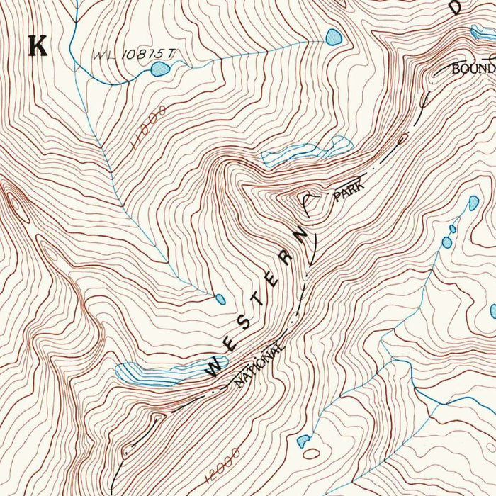
Triple Divide Peak itself is the commanding geographic idea behind the sheet: a summit whose surrounding slopes help separate major Sierra watersheds. In this country, ridgelines are not merely scenic boundaries but hydrological architecture, directing snowmelt toward the Kings River, Kern River, and Kaweah drainage systems. The map’s contour lines gather tightly around summits and ridges, conveying the abrupt verticality of the southern Sierra Nevada. Valleys open below in elegant patterns of creeks, lakes, meadows, and forested slopes, while the surrounding unnamed heights remind the viewer how much of this region remains defined by wilderness rather than settlement. It is a map of altitude, remoteness, and water in motion.
Among the named features, Lower Kaweah Lake, Upper Kaweah Lake, Emerald Lake, and Lake Dorthy stand out as high alpine jewels set into glacially carved basins. Their blue forms contrast with the finely drawn contouring around them, emphasizing the way ice and elevation shaped the Sierra’s topography. Soda Creek and other tributaries thread through the terrain, while the larger river systems implied on the sheet connect these secluded headwaters to California’s broader ecological and agricultural geography. Meadows, forested areas, and exposed mountain slopes are carefully differentiated through the USGS color language, creating a practical navigational document that also reads as a richly layered portrait of wilderness.
The inclusion of the High Sierra Trail and Pacific Crest Trail gives the map a strong human dimension without diminishing its wild character. These routes trace some of the most celebrated long-distance passages in the American West, crossing high passes, skirting lakes, and linking remote basins across the Sierra crest. For hikers, climbers, rangers, and scientists, a 1:24,000 USGS quadrangle such as this was an essential companion, translating difficult ground into readable form. The map’s close contour intervals and careful depiction of drainages, ridges, and trail corridors reveal not only where one might travel, but how demanding that travel would be across this monumental terrain.
As a work of the United States Geological Survey, “Triple Divide Peak” belongs to a cartographic tradition devoted to public knowledge, resource management, conservation, and scientific record-keeping. By the early 1990s, maps like this were indispensable tools for understanding protected landscapes, particularly in national parks where ecological change, visitor access, wildfire management, and watershed health all demanded precise geographic information. Today, it offers historical value beyond navigation: a fixed image of the Sierra Nevada before decades of accelerating climate concern, changing snowpack patterns, and evolving conservation priorities. In its disciplined lines and restrained colors, the map preserves a moment in the ongoing study of one of California’s great mountain landscapes.
Cities, towns and places on this map
- Sequoia National Park
- Kings Canyon National Park
- Triple Divide Peak
- Sierra Nevada mountains
- Lower Kaweah Lake
- Emerald Lake
- Lake Dorthy
- Upper Kaweah Lake
- High Sierra Trail
- Pacific Crest Trail
- Kings River
- Soda Creek
- Kern River
- Valleys and ridges within the Sierra Nevada range
- Unnamed peaks and elevations
- Forests, meadows, and mountainous terrain
Historical context & cartographic details
- Published by the United States Geological Survey (USGS)
- Created in 1993 and published in 1994
- Provisional map status indicated
- Focuses on Sequoia National Park, California, with broader surrounding regions included
- The USGS is known for extensive topographical mapping that supports natural resource management, conservation, and scientific research
- Displays contour lines to show elevation changes
- Uses color coding to distinguish landforms and water bodies
- Map scale of 1:24,000 provides a detailed view of mountainous terrain for navigation and landscape analysis
- Reflects early 1990s environmental and geographical data useful for historical and ecological study
- Can be compared with later maps to explore changes in land use, conservation efforts, and climate-related impacts
Looking for a particular place? Review the detailed images to confirm that the town, landmark or feature you have in mind appears on the map. If you are unsure, ask our workshop to check before you order.
Detailed maps are especially rewarding at larger sizes, where names, boundaries and decorative features have more room to be appreciated. Use the close-up preview and size guide to choose the right scale for your wall.
This map looks amazing at sizes all the way up to 50in (125cm). If you are looking for a larger map, please get in touch.
The model in the listing images is holding the 16x20in (40x50cm) version of this map.
Where personalisation is available, you can add a short title or dedication, mark one meaningful place, or request one considered visual detail. See personalised map examples.
Every piece is printed to museum-grade archival standards using fade-resistant pigment inks on acid-free matte paper. Choose an unframed map print, framed map or canvas using the finish options above. Framed maps use crystal-clear optical acrylic and arrive ready to hang.
With its rich detail and strong sense of place, this map makes a considered gift for a new home, anniversary, retirement or anyone with a personal connection to the area shown. Still deciding? Explore our collection of rare old and vintage maps to discover another place, period or style.
Share